Bushfire recovery support and resources now available for land managers affected by the Deep Creek and Nangkita fires.

McLaren Vale Prescribed Wells Water Allocation Plan
McLaren Vale Prescribed Wells Water Allocation Plan
Water is essential to life, livelihoods and the environment.
To make sure there’s enough to go around, now and into the future, we need to manage it carefully. Water Allocation Plans (WAPs) help provide that certainty. They set out clear rules for how water can be shared, balancing the needs of people, industry and the environment, while supporting long-term sustainability.
The McLaren Vale Prescribed Wells Water Allocation Plan is built on strong scientific research and shaped through extensive community consultation. It reflects both the best available knowledge and the views of local water users, continuing the region’s proud tradition of proactively managing its groundwater sustainably.
You can download the plan below to learn more.
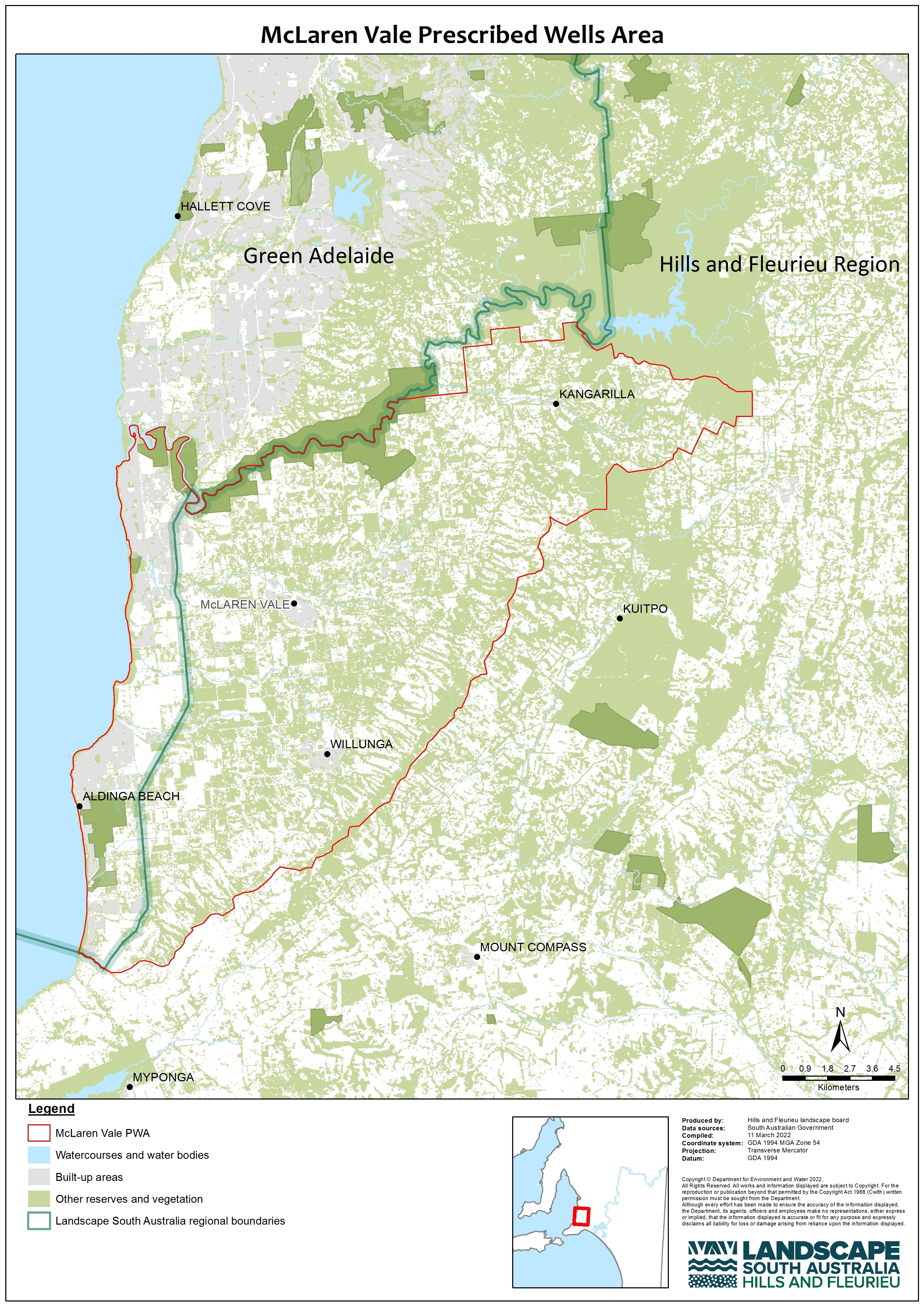
The area covered by the plan
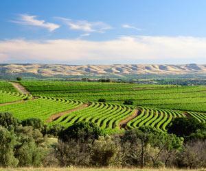
The McLaren Vale Prescribed Wells Area, commonly known as the Willunga Basin, encompasses the townships of Aldinga, Willunga, McLaren Vale, McLaren Flat and Kangarilla.
The McLaren Vale Prescribed Wells Area lies entirely within the traditional land of the Kaurna Nation.
Groundwater coming to the surface supports numerous wetlands in the region, with Blewitt Springs, Washpool, Aldinga Scrub and Maslin Creek Reed Swamp being significant examples. Base flow from groundwater supplements flow in a number of watercourses, which is significant during the drier months.
Grapevines make up 96% of the gross value of irrigated agriculture in the area and underpins a local economy based on winemaking and tourism. The McLaren Vale region represents more than $500 million in gross regional value to the state and national economy.
Review of the McLaren Vale Water Allocation Plan
The plan, first adopted in 2007 and reviewed without amendment in 2011, was most recently reviewed in 2022.
The Hills and Fleurieu Landscape Board led this process with input from local water users, industry, Kaurna representatives and technical experts. The review looked at how well the plan has worked and whether it is fit for the next decade.
The review found groundwater extraction to be well within the limits set. However, the McLaren Vale Water Allocation Plan requires amendment to address the following;
First Nations (Kaurna) interests are not recognised;
Rising groundwater salinity has been identified as posing a high risk in some localised areas;
Small long-term downward trends in the levels of some aquifers need to be better understood;
More information is needed to understand groundwater dependent ecosystems;
Rules are not able to be set at an aquifer or management zone level;
The plan lacks a set of overarching objectives; and
The current plan does not consider impacts of climate change.
Amendments are now being considered to address review findings. This work includes:
- Engaging water licence holders in areas affected by salinity
- Investigating aquifer trends
- Starting policy change discussions in early 2024, with community input
Until amendment is complete and a new set of policies are adopted, the current policies (including water allocations to existing users) will remain unchanged.
As part of the review, the importance of managing surface water and groundwater together was a key consideration. Currently, groundwater in the McLaren Vale and Willunga Basin is managed under the McLaren Vale Water Allocation Plan, while surface water is covered by the Western Mount Lofty Ranges Water Allocation Plan.
In 2022, the Hills and Fleurieu Landscape Board sought additional community input on this issue, including a public forum held in August. A summary of discussions and a Q&A sheet responding to questions from the forum are available below.
Following this engagement and advice from the McLaren Vale Community Advisory Committee, the board made the decision to amalgamate the two plans. This will allow for a more integrated and effective approach to managing water resources.
Why amalgamate the plans?
- Surface water and groundwater are deeply interconnected. Rainfall and surface flows recharge aquifers, while in some areas, groundwater discharges into springs and watercourses (known as baseflow).
- Water-dependent ecosystems in McLaren Vale rely on both surface and groundwater. In dry months, steady groundwater discharge helps them persist, while variable surface flows support biodiversity.
- Both surface and groundwater extraction can affect these ecosystems.
- Integrated planning ensures both systems are considered together, in line with best-practice water management. Policy decisions for one resource can impact the other.
The amalgamation won’t take effect until a new Western Mount Lofty Ranges Water Allocation Plan is adopted.
In the meantime, both the current 2007 McLaren Vale Water Allocation Plan and the 2013 Western Mount Lofty Ranges Water Allocation Plan remain in effect.
Ongoing monitoring of groundwater in the McLaren Vale Prescribed Wells Area is carried out by the Department for Environment and Water and the Hills and Fleurieu Landscape Board.
Monitoring results are used to produce annual status reports and help guide the sustainable management of the region’s groundwater resources.