Bushfire recovery support and resources now available for land managers affected by the Deep Creek and Nangkita fires.

Updating the Water Allocation Plans
- Project status Current
Updating the Eastern and Western Mount Lofty Ranges Water Allocation Plans
The Water Allocation Plans for the Eastern and Western Mount Lofty Ranges have been reviewed and are now being amended.
The process to amend these plans began in 2025 and is expected to continue through to 2029, resulting in updated Water Allocation Plans for both regions.
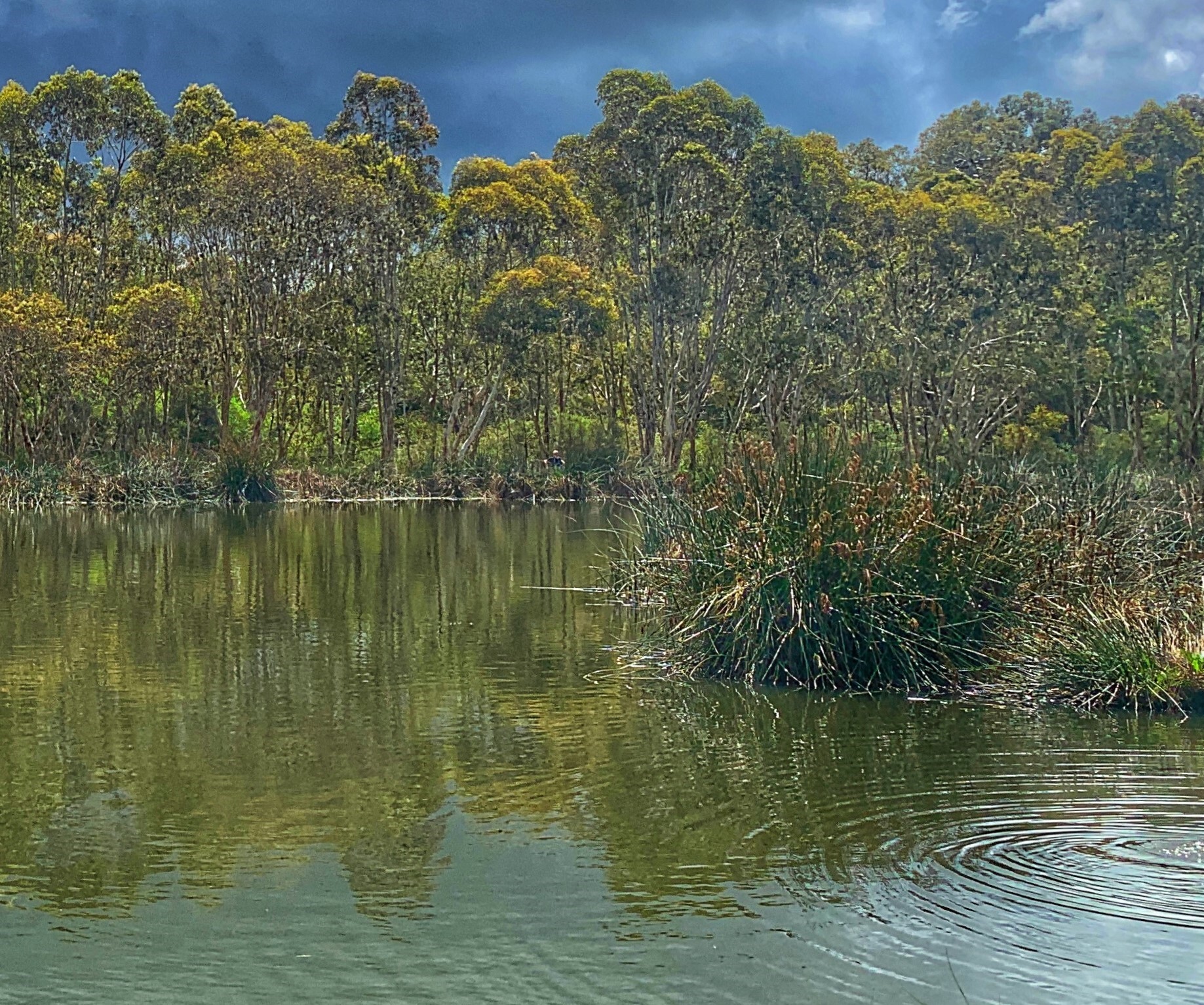
This is an important opportunity to reflect on how water is shared and used across our catchments, and how different uses collectively affect natural flow paths, farms and aquatic ecosystems. Healthy creeks and rivers support native species, productive landscapes and resilient communities, and achieving this relies on shared solutions.
Supporting sustainable water use into the future may involve practical changes on the ground, as well as ongoing conversations about how we value and manage water across our communities.
Planning for climate change is also essential, as rainfall patterns shift and water availability becomes less predictable.
Throughout the amendment process, all water licensing business will continue as usual. The Department for Environment and Water remains your key contact for all licensing matters.
The review of the current Water Allocation Plan's found that they were successful in:
Establishing a framework for water licensing and trading.
Introducing additional controls on the development of dams.
Proposing strategies to mitigate the impact of dams on catchment flows.
Key learnings of the review were:
Groundwater resources are currently stable in most areas.
Water-dependent ecosystems are declining in many parts of the region due to altered flow patterns caused by water storages and water diversions.
Water resources are over-allocated in many areas.
Climate change is influencing the timing and quantity of rainfall. This requires updated data and analysis methods.
First Nations involvement in planning process is crucial for progress.
More information and new approaches need to be explored to manage forestry and stock and domestic water use in future.
The amendment process involves developing policy revisions or new policy elements in alignment with findings identified during the review process.
These revisions are developed with support from the Water Allocation Plan Advisory Committees. They are then further tested with stakeholders and community through consultation. Feedback from consultation may result in revisions being changed and then tested again with stakeholders and community. The process is iterative as revisions are interconnected.
The amendment phase has commenced and will involve detailed technical investigations to address knowledge gaps and will also include significant community engagement, including:
Forming Water Allocation Plan Advisory Committees (WAPACs).
Consulting targeted interest groups.
Engaging with communities in the Eastern and Western Mount Lofty Ranges.
We are mindful that water users need to be kept informed of the process and any changes that could impact their businesses so that they can plan and make informed decisions. Throughout the process we will ensure to communicate:
clear information about any imminent changes so that it enables forward planning for water users,
how the changes might impact water users,
the types and scale / extent of amendments that are required,
the type and source of information and evidence that will be used to address knowledge gaps during the amendment process, and
the intended outcomes of any amendments (i.e. how the balance between environment, business and social values/needs are weighted).
We will continue engaging with communities and interest/business groups as our understanding grows and can be applied. As the amendment process continues, we encourage you to stay informed and participate in upcoming opportunities.
Be part of the conversation
Work is underway to design the consultation approach for revising the water allocation plans. Updating the plans will be a complex process and involve input from a wide range of stakeholders.
We’re committed to working with the community to improve how water resources are managed across the Mount Lofty Ranges.
If you have any questions or would like to learn more, please get in touch.
Please follow our Facebook page for updates and check back on this web page as the process progresses.
The Hills and Fleurieu Landscape Board is responsible for the review and amendment of the Eastern and Western Mount Lofty Ranges Water Allocation Plans (WAPs) in accordance with the Landscape South Australia Act 2019. The implementation of the plans is a shared responsibility with the Department for Environment and Water.